Hi everyone,
After a shower and a some medical care for my cutts I am feeling much better. Zammi, the picture looks nice though fortunatly I don't have knee problems.
I won't write a lot cause usualy the story isn't told very well in writing in my opinion but,
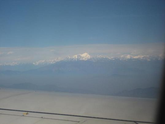
the view from the airplane is like this:
We started our trek in Sundarijal ,on the outskirts of Kathmandu and entered the Shivapuri National park
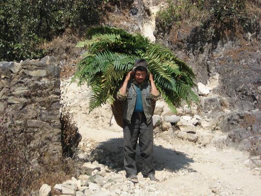
The terrain is mostly forest and big hills and terraces.
but you hike about a 1600m up and 800m down that day. and we were fully packed with the snow gear so it was not easy.
We got lost a couple of times cause the route is not very clear sometimes and since it is off season you hardly see any tourists along the way. and not all the local settelments are inhabited.
another crazy thing is that there is no electricity even in Kathmandu for 16 hours a day!!!!
so, when it was getting dark and we still haven't reached our destination we turned to the only source of light we saw....which was a village 1000m down a ridge.
but after a few minutes we got it together and pulled our head lamps and compass and navigated our way back and found Chisapani.
Only to find out the it was 50m above our heads all the time but with no light we couldn't see it.
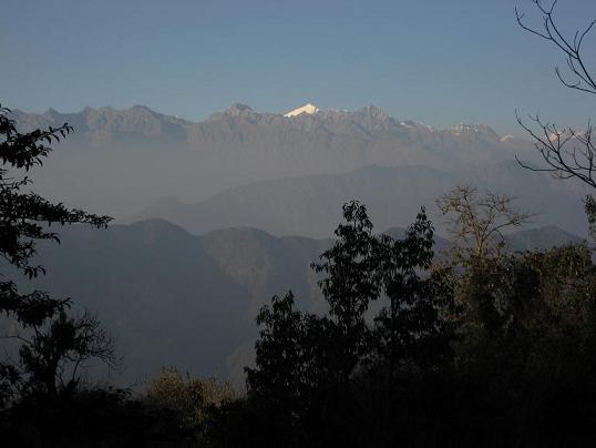
Along the way we started to get a glimps of what is awaiting ahead of us:
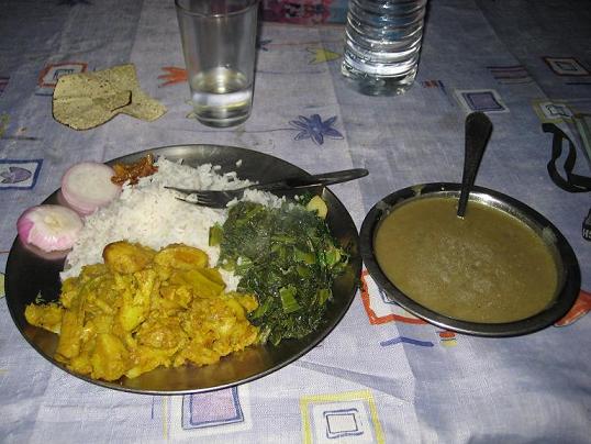
The most known Nepali meal is the DalBaht:
We are tired and I started to feel a sharp pain in my ankles that turn out to be really bad bruises and cutts.
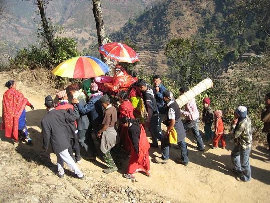
Next day we walked to Kutumsang and along the way we decided it was not fun any more and decided to get rid of a few things we could spare in order to loose weight. We saw a Napali wedding:
By noon we got lost again and decided that because it is an off season and it is getting annoying we will finish the day the decide about the rest.
The route is rough and rugged and with the weight on our backs and my growingly souring ankles we got to Kutumsang and decided to take a porter.
We met Surki Sherpa, a lovely local lodge owner who agreed to be our porter. He is a quiet and shy person with a really good heart.
So, we continued our trek with Surki as a porter and a guide. And man, it was the right call . The following day has a murderous hike up to Mangengoth (1000m) and then down 500m and then up again for 500m and then down for 200m and then up for 400m....well you got the idea I guess. And the route is usually ok but you can get lost lots of times.
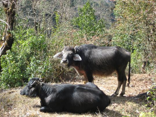
we saw locals and Yaks!
We are now in Tharepati 3600m.
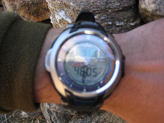
Continuing to Phedi and then to the Laurabbina Pass - 4600m
But forget this....You wanna see the Himalayas
our altitude meter when we reached the pass:
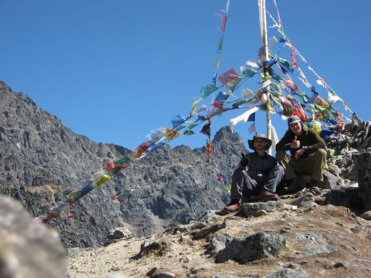
Us at the pass with the prayer flags:
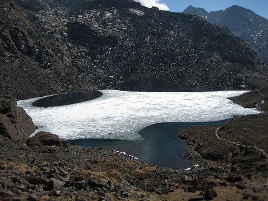
Shiva's Sacred Lakes near the pass:
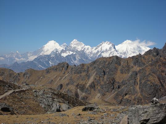
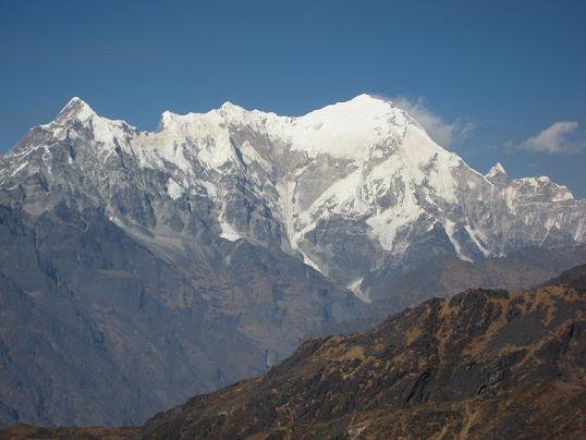
The Himalays my friends:
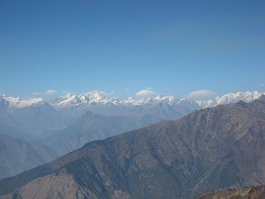
Langtang Lirung 7246m and Langtang II 6581m:
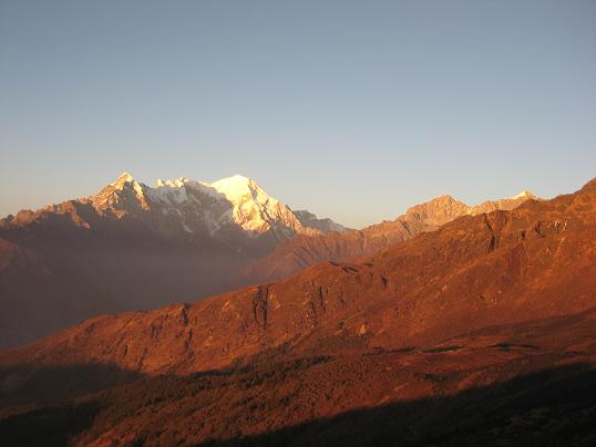
and last picture at sunset you can see the right most pick with a bit of snow. This is the Naya Kanga and the Ganja La pass we will attempt (and Succeed!!!!) to climb.
I have a lot more but can't get it all in one time. Hope it is enough for now. Take care and I'll be online for the next few days till we head back to our trek. In the mean time...
Namaste
imtl39865.3730208333